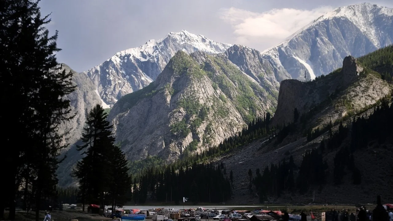

Mushkpuri, also known as Mukshpuri Peak, is a mountain in the Galiyat region of Khyber Pakhtunkhwa — the strip of hill stations between Murree and Abbottabad that also includes Nathia Gali, Dunga Gali, and Ayubia. Mushkpuri is the second-highest peak in the whole Galiyat range, just behind Miranjani, and it’s become one of the most popular short treks in the area precisely because it delivers a genuine summit experience in a single day.
Where Is Mushkpuri Top Located?
Mushkpuri sits in the Nathia Gali Hills, within the Circle Bakote area of Abbottabad District, Khyber Pakhtunkhwa, at roughly 34°04′N, 73°23′E. It stands at approximately 2,800 to 2,900 metres (9,200 to 9,450 feet) — the second-highest point in Galiyat after Miranjani, which tops out around 2,980 to 2,992 metres (9,816 feet).
The peak sits inside Ayubia National Park, directly above Dunga Gali, with Nathia Gali as the other common access point. On a clear day, the summit offers views stretching to the Kashmir Valley, the Jhelum River, Murree, Islamabad, and — if conditions line up — the distant Himalayan range, including Nanga Parbat.
How to Reach Mushkpuri Top — Distance from Major Cities
| From | Distance | Approx. Time | Notes |
|---|---|---|---|
| Islamabad | ~90 km | ~2.5 hrs to Nathia Gali/Dunga Gali | Most consistently cited figure; via Murree Expressway |
| Rawalpindi | ~90–95 km | ~2.5 hrs | Essentially the same route as Islamabad — the two cities are adjacent |
| Lahore | ~460–465 km (estimated) | ~7 hrs | No single source states this directly; reconciled from Islamabad–Lahore (~375 km) plus the Islamabad–Nathia Gali leg, and matches an independent 7-hour estimate for the area |
| Murree | ~30 km | ~45 min–1 hr | Via the Murree–Abbottabad road to Dunga Gali |
| Ayubia National Park | ~75 km from Islamabad | — | Slightly closer than Mushkpuri itself, sits just before Nathia Gali on the route |
Once you reach Dunga Gali or Nathia Gali, the road ends — the summit itself is reached only on foot from there.
Hiking Trail Guide: Routes to the Summit
There are two common starting points, and — worth being upfront about — sources genuinely disagree on which one is easier, so both are presented here rather than asserting a single answer:
- From Dunga Gali: around a 4 km climb, which some sources describe as the shorter, more moderate option suitable for beginners and families.
- From Nathia Gali (via the Pines Hotel area): a similar-length climb through pine forest, which other sources describe as the easier, more popular trail — while still others call it the steeper option.
Most hikers reach the summit in 2 to 4 hours, with competitor tour operators commonly quoting 3 to 4 hours one way at a guided group pace, and fitter solo hikers doing it closer to 1.5 to 2.5 hours. The trail itself — part of the broader Ayubia Pipeline Track network, a 4 km walking trail originally built alongside Murree’s water-supply pipeline — winds through pine forest with a mix of gentle stretches and a few genuinely steep sections nearer the top. There’s a small natural water pond at the summit and open grassy ground, which is why it also doubles as a popular camping spot.
Mushkpuri Top Weather & Best Time to Visit
Because of the altitude, Mushkpuri stays noticeably cooler and breezier than the towns below it, even when Nathia Gali or Murree feel mild. Weather can shift quickly at this elevation, so a layer is worth carrying regardless of season.

Data: WeatherAPI/WorldWeatherOnline historical averages for Nathia Gali (nearest station, elevation 2,410m). Mushkpuri’s summit sits roughly 400–500m higher, so expect readings 2–3°C cooler than shown, especially at the exposed summit.
| Season | Months | What to Expect |
|---|---|---|
| Spring/Summer | March–June | Clear trails, wildflowers, greenest scenery, avg 13–26°C |
| Monsoon | July–August | Heaviest rainfall of the year (18–19 rainy days/month); trail can get slippery |
| Autumn | September–November | Cooler, clearest skies of the year (up to 9.8 sun hrs/day in October), thinner crowds |
| Winter | December onward | Snow-capped peak and trail; avg drops to 6–8°C in the valley, colder at the summit |
The broadly recommended window for the wider Galiyat region is March to November. Mushkpuri in winter is a real, separate draw rather than something to avoid outright — snow typically begins falling from December, and by mid-winter the peak and trail are fully snow-covered. It’s a legitimately popular snow-trekking destination, though proper winter gear (and ideally a guide familiar with the snow-covered path) matters far more here than in the March–November window.
Nearby Attractions
- Ayubia National Park: Spanning roughly 3,312 hectares at around 2,400 m (8,000 ft) elevation, this is the protected forest area Mushkpuri sits within. It includes a chairlift, numerous picnic points, and is one of the last strongholds of Himalayan temperate forest in Pakistan.
- Dunga Gali: The main southern access point for Mushkpuri, also the start of the Ayubia Pipeline Track.
- Nathia Gali: The alternate, more developed access point, with its own bazaar, hotels, and a separate waterfall (Nathia Gali Waterfall) worth a stop if time allows.
- Lalazar Park: A small park right near the Nathia Gali bazaar, within easy walking distance of the Mushkpuri trailhead area.
- Khanspur: One of the mini-resort villages that make up the Ayubia National Park complex, a short drive from the main Nathia Gali–Dunga Gali stretch.
- Jannat Waterfall: Mentioned in some local travel content as a nearby spot, though we weren’t able to independently verify details on this one — worth confirming locally before including it as a stop.
Mushkpuri vs. Miranjani
| Mushkpuri Top | Miranjani Top | |
|---|---|---|
| Elevation | ~2,800–2,900 m (9,200–9,450 ft) | ~2,980–2,992 m (9,816 ft) |
| Rank in Galiyat | 2nd highest | Highest |
| Trailheads | Dunga Gali or Nathia Gali | Dunga Gali or Nathia Gali |
| Typical trek time | 2–4 hours | ~5 hours one way (longer, more demanding) |
| Good for | Day hikers, families, a manageable first summit | Experienced hikers wanting a longer, higher trek |
Where to Stay
Mushkpuri Top itself has no accommodation — it’s a day-hike destination. Most travelers base themselves in Nathia Gali or Dunga Gali, both of which have a range of hotels, guesthouses, and a few retreat-style properties, generally within a short drive of the trailhead. Camping on the summit itself is also an option for those equipped for it, given the open, flat ground and the small natural pond at the top.
What to Pack & Safety Tips
- Sturdy, broken-in hiking shoes — the trail has rocky and uneven sections
- Layered clothing — temperatures swing noticeably between the base and the summit, even in summer
- Rain gear during monsoon months (July–August)
- Proper winter gear (insulated jacket, gloves, solid grip footwear) if hiking after December
- Enough water and some snacks — there are no shops along the trail itself
- A local guide, especially for winter hikes or if attempting the less-frequented of the two routes
- Basic first-aid kit and any personal medication
- A fully charged phone and, ideally, an offline map downloaded in advance
Frequently Asked Questions
Where is Mushkpuri Top located? Mushkpuri Top is in the Nathia Gali Hills of the Galiyat region, Abbottabad District, Khyber Pakhtunkhwa, within Ayubia National Park.
How long is the hike to Mushkpuri Top? Typically 2 to 4 hours to the summit, depending on route, fitness level, and pace — guided group tours commonly plan for 3 to 4 hours one way.
Is there snow at Mushkpuri Top? Yes. Snow generally begins from December onward, and the peak and surrounding trail stay snow-covered through winter.
Is the Mushkpuri Top trek difficult for beginners? It’s generally considered a moderate, beginner-manageable trek, though there are some genuinely steep sections regardless of which route you take.
What is the best time to visit Mushkpuri Top? March to November covers the main trekking season with clear trails and green scenery. Winter (December onward) is a separate, snow-trekking experience best attempted with proper gear and ideally a guide.
Is Mushkpuri Top safe in winter? It can be, with the right preparation — insulated clothing, grip-appropriate footwear, and a guide familiar with the snow-covered trail. Conditions are considerably more demanding than the rest of the year, so this isn’t a casual off-season version of the summer hike.
Can families visit Mushkpuri Top? Yes — the moderate difficulty and manageable trek length make it one of the more family-friendly summit hikes in the Galiyat region, especially via the Dunga Gali route.
Ready to do the hike without planning the logistics yourself? See our 1-Day Mushkpuri Top Tour — guided transport, breakfast and dinner, and a professional guide for the full day.